The National Weather Service issued a High Wind Warning for Grays Harbor County and most of Washington state’s coast that expired about 4 a.m. on Tuesday. The service also issued a flood warning for the Satsop River near Satsop on Tuesday.
The flood warning repeated by Grays Harbor County Emergency Management said, “The river is expected to rise above flood stage at around (9 a.m. Tuesday) and crest later (Tuesday) morning.”
Minor flooding was forecast and drivers were advised to be careful.
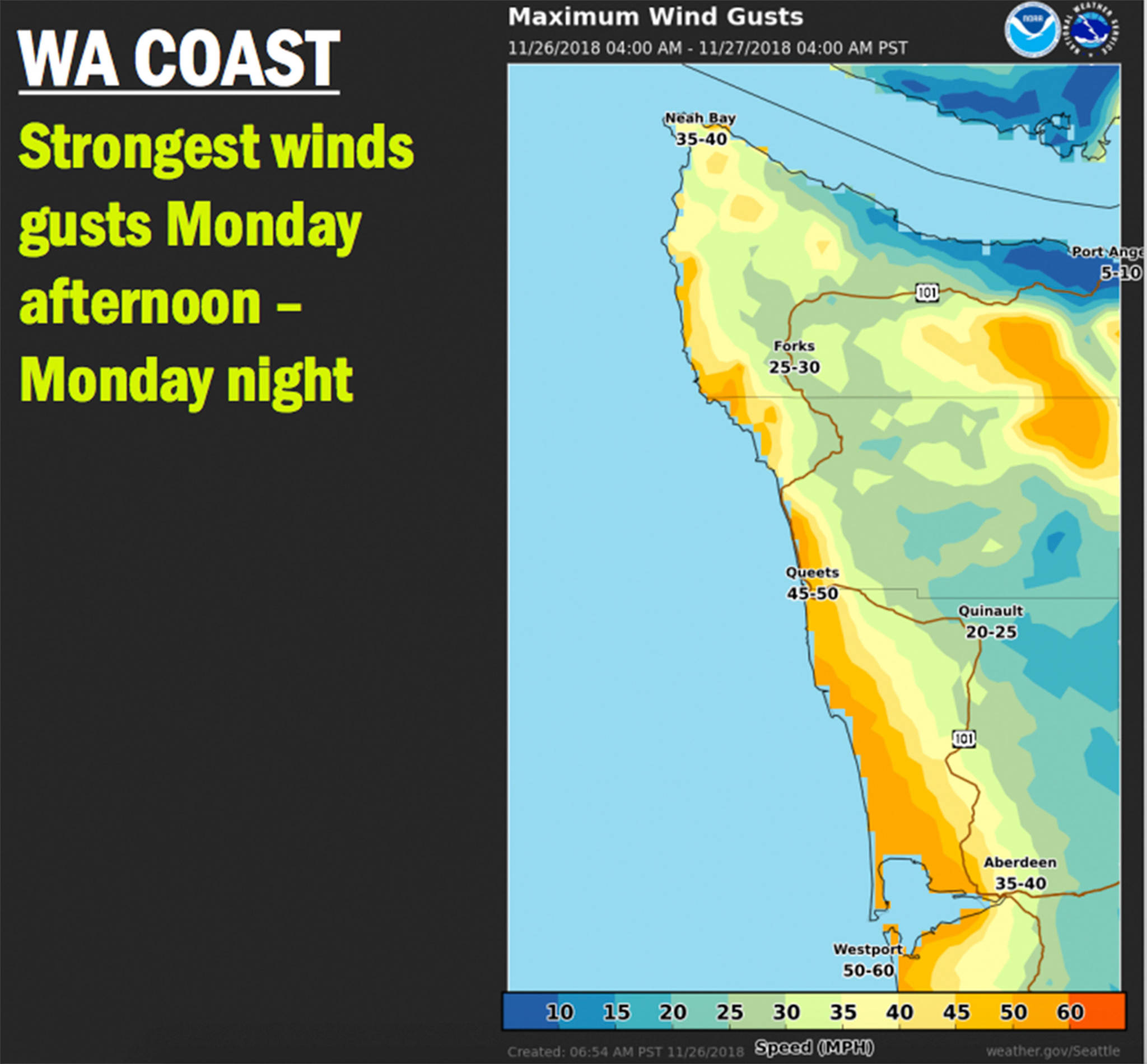
The coast, from Westport north to Moclips, experienced winds between 50 and 60 mph, according to the National Weather Service.
Since the initial high wind warning, the projected wind speeds in interior areas at Aberdeen and Hoquiam were upgraded to 35 to 40 mph, said Deputy Director Hannah Cleverly from Grays Harbor County Emergency Management.
Since this was the first significant windstorm this season, impacts like snapped branches and downed-trees likely were widespread, the National Weather Service wrote. Cleverly reminded that with such high winds, loose objects could be blown away.
There also was significant rain throughout most of Grays Harbor County and particularly in the Olympic Mountains. Areas around Grays Harbor are predicted to get between 2 and 3 inches of rain, which increases to 4 to 6 inches of rain near Lake Quinault and 6 to 10 inches near the middle of the Olympic Mountains.
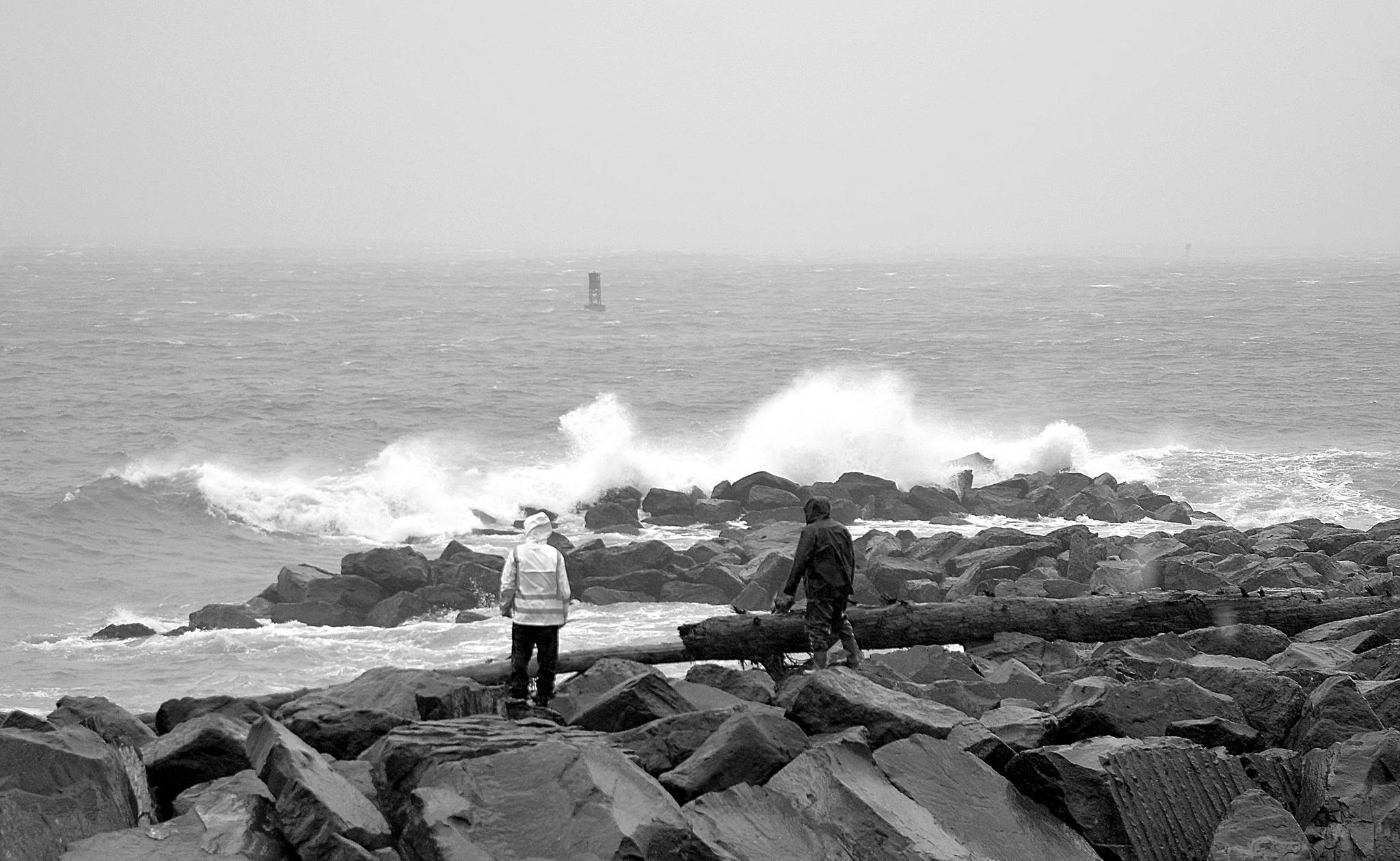
DAN HAMMOCK | GRAYS HARBOR NEWS GROUP Gusts nearing 50 mph were recorded at Westport Monday afternoon, according to the National Oceanic and Atmospheric Administration. A high wind warning is in effect until 4 a.m. Tuesday.